

Thunderstorm warnings have been issued for large parts of the country, lasting from lunchtime until Monday night.

The Met Office says thunder and heavy downpours could cause flooding and travel problems.
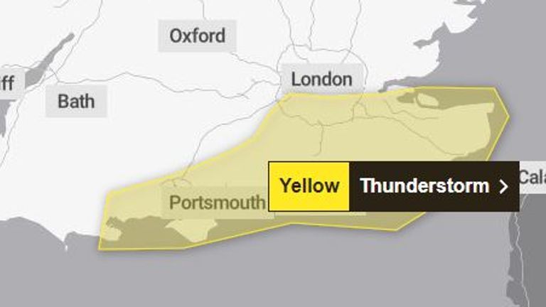
Southeast England – including Kent, Sussex, Surrey, Hampshire and south London – could be affected from noon, says the forecaster.
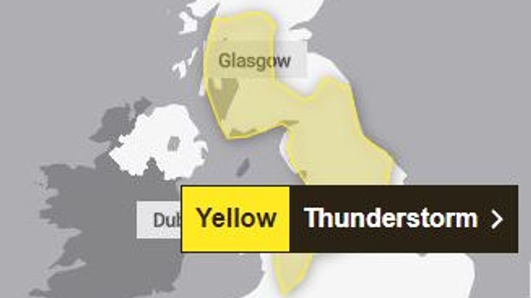
Other areas affected are mid-Wales and most of northern England, stretching up past Glasgow into southwest Scotland.
That warning is in force from 1pm – with both alerts ending at 9pm.
“Spray and sudden flooding could lead to difficult driving conditions and some road closures,” says the Met Office, while there is also a small chance that roads and properties could be flooded.
Bank Holiday Monday has brought a grey and cloudy start for many, with forecasts ranging from 12C (53F) in the Hebrides to 18C (64F) in northern England at 1pm.
However, it will become warmer, brighter and drier from Tuesday with high pressure forecast for much of the UK – and it should stay that way for next weekend.
Temperatures in London are expected to be 23 degrees Celsius (73 degrees Fahrenheit) and sunny skies next Saturday and Sunday, according to the Met Office.
Highs of 20°C (68°F) are expected in Edinburgh, while sunny skies and 19°C (66°F) are expected in Cardiff and Belfast, with highs of 20°C. Expect it to be still warm to the touch.